The five self-drive routes China ranks highest, and how they hold up for foreigners
Chinese road-trippers rank their own routes every year. We took the five at the top of the 2024 list, drove them with a foreign family in the car, and scored each for driving difficulty, physical demand, facilities and adventure.
The five self-drive routes China ranks highest, and how they hold up for foreigners
Five road trips in China, all road-tested by us at Dragon Roads on the trips where we drove more than 20,000 km across the country. If you want the short comparison of the regions we drive rather than a ranking, that is Best road trips in China: which region to drive.
Here's something you may not know: the road trip is how Chinese travelers most love to see their own country already. In 2024 it reached 4.35 billion trips, up 750 million on the year before, and 77.4% of all domestic travel. Road trip is the single most popular way to travel for locals (China Tourist Automobile and Cruise Association, 2024–2025 report). As of 2026, more than two in three domestic trips are now made behind the wheel.
Why? A car drops you into local life and gives you the run of the journey: pull over for a coffee by Sayram Lake, wait while cattle cross the road on the Qilian grassland, add a few nights for a hike into Shangri-La's sacred mountains, or detour into a small town for a bowl of hand-pulled noodles in Dunhuang. China is huge and wildly varied: snow mountains, grasslands, deserts, salt lakes, Danxia cliffs, karst peaks, ancient towns, and much of its best scenery is on the road itself, where trains and tour buses don't go. With a dense expressway network and charging stations almost everywhere, the road trip is just the way to go today for locals.
If you're visiting China and want more than its big cities, read on.
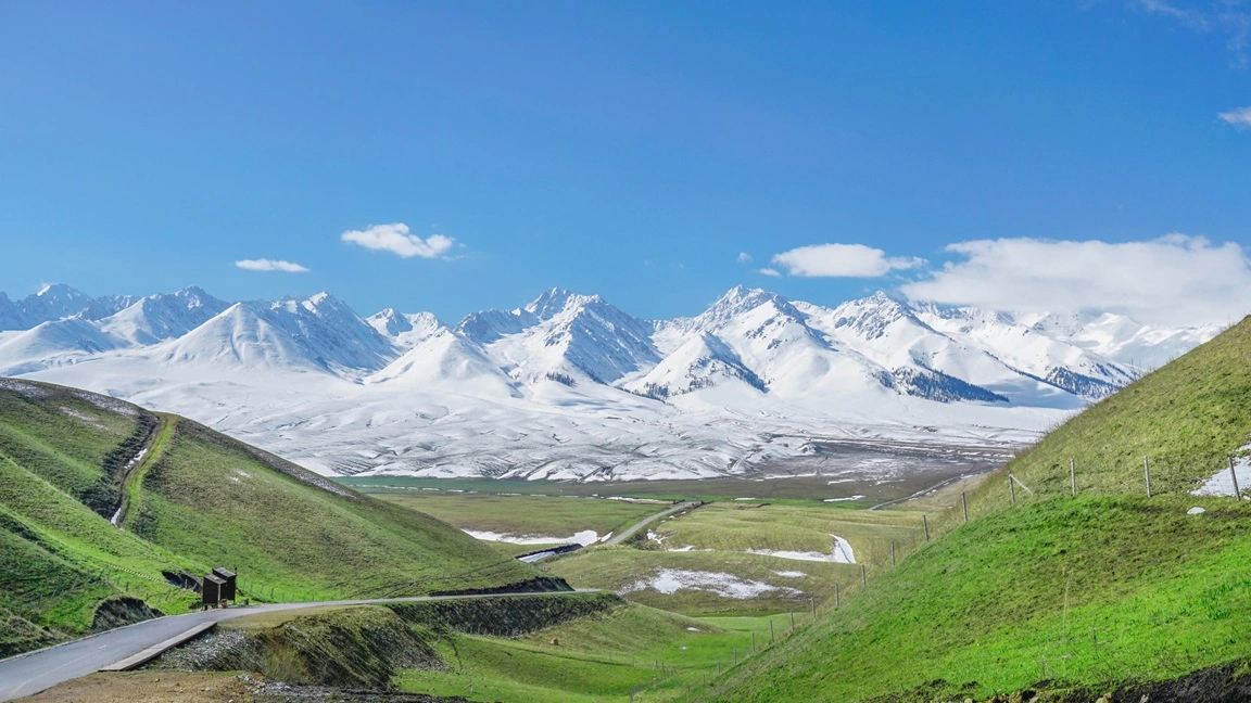
[Self-drive trip at Sayram Lake]
[Road to Qinghai-Tibetan plateau]
What Do We Mean by "Quality"?
You can probably find plenty of self-drive routes for China on social media, but many simply reuse the same itineraries written for Chinese travelers, rushing you along, including stops foreigners can't even enter, or failing to flag road conditions that could be risky. Every route here meets all of these standards:
- Drawn from routes Chinese travelers already love. Based on 2024 research and rankings by professional institutions, then re-selected for what foreign visitors actually need.
- Sights you'll find only in China. Landscapes and cultures unique to the country: scenery, history and people alike.
- More time to explore. No driving just to cover ground; room to slow down and stay somewhere with character.
- Open to foreign nationals, with no special permits needed.
- Good roads throughout. Paved the whole way; no special vehicle or skill required.
- Reliable service infrastructure. Enough fuel and charging stops, and nice hotel selection.
- Comfortable daily distances. Most days are around 200 km or less; the longer ones are flagged.
- Well-run sites, no hidden fees. Many of the destinations are free to enter.
- No driving through big-city centers, so you skip traffic restrictions and jams.
- Same start and finish, so flights are easy to line up.
In short: we chose these five by matching the routes Chinese road-trippers rank highest against our own driving, more than 20,000 km across China, all with a foreign family along. Proven on the rankings and tested by us on the ground, they're easy to drive and full of surprises.
[Florian was checking his car after a trip with his family back from the edge of Kekexili, China's no man's land]
The Top 5 at a Glance
| # | "Quality" Route | Ranking-List Name | Core Region | Self-Drive Days | Best Season |
|---|---|---|---|---|---|
| 1 | The Western Frontier (Northern Xinjiang · Ili) | Northern Xinjiang Loop | Ili, Xinjiang | ~8–9 days | Jun–Sep |
| 2 | Shangri-La Heights (Northwest Yunnan) | Lijiang–Dali–Shangri-La Route | Northwest Yunnan | ~10–11 days | Apr–Oct (shortened winter version available) |
| 3 | Silk Road Odyssey (Qinghai–Gansu) | Qinghai–Gansu Loop | Qinghai & Gansu | ~8–9 days | Jun–Oct |
| 4 | Guizhou Hidden Gem (Guizhou) | Huangguoshu–Xijiang–Libo–Fanjingshan Route | Guizhou | ~8–9 days | Aug–Apr |
| 5 | Southern Xinjiang · Kashgar–Pamir Loop (Silk Road southern exit) | Southern Xinjiang Loop | Kashgar & Aksu, Xinjiang | ~9–10 days | Jun–Sep |
About the "ranking-list name": all five rank in the top ten most-visited self-drive routes (summer 2024) in Measuring Beautiful China by the Wheel: 2024 China Self-Drive Tourism Report (New Era Institute of Culture and Tourism, Sep 2024); we've refined them here for foreign travelers. Report: https://www.fxbaogao.com/view?id=4516202
"Days" covers the self-drive segment only, not flights or stopovers. Add 1–2 days in your arrival city for rest, jet lag and getting your temporary driving permit; with those, each trip fits comfortably within about two weeks.
1. The Western Frontier (Northern Xinjiang · Ili)
The best of northern Xinjiang, the Ili Valley: Urumqi + Sayram Lake + Yining + snow-mountain grasslands + hidden canyons. Our region page: Xinjiang.
[Northern Xinjiang · Ili, map]
[Northern Xinjiang · Ili]
The Ili Valley, "a green oasis beyond the Great Wall", was the last great crossroads on the northern Silk Road inside China. It packs in Xinjiang's most photogenic scenery: deep-blue alpine lakes, grasslands running up to the snow line, and steep canyons, alongside the food and daily life of the Uyghur, Kazakh and other peoples. Hiking, riding, barbecue, camping: it's all here. The route links the cities of Urumqi, Yining and Tekes (a town laid out as the bagua, or eight trigrams), passes the northern Duku Highway (often called one of China's finest drives), and threads through some of the country's best national parks.
Best season: June–September, when the grasslands are greenest, the lakes bluest and the fruit sweetest, and the Duku Highway is open for the full loop (reservation required to pass through). In winter most grassland sites close and few places are reachable, so self-driving isn't recommended.
Time needed: About 8–9 days.
Main route (round trip from Urumqi): Urumqi → Sayram Lake (a deep-blue alpine lake, with a loop drive) → Yining (Six-Star old quarter) → Tekes Bagua Town / Kalajun grassland → Nileke (Fairy Lake; Mengkete Ancient Trail hike) → Nalati grassland → Dushanzi Grand Canyon → back to Urumqi.
Approx. distance: 1,300–1,600 km. Most days are easy; only Urumqi → Sayram Lake is long (about 500+ km), though almost entirely on smooth expressway. Start early, and split it with a night in Jinghe if needed.
Driving difficulty ★★☆: Moderate. Almost all expressway with good roads; even the long first day is highway the whole way.
Physical demand ★☆☆: Fairly low. Mostly sightseeing and lake loops; hikes can be as long or short as you like.
Facilities ★★★: Well-developed. Fuel/charging in towns, comfortable lodging and dining throughout; book ahead in peak season.
Adventure level ★★☆: Medium. Classic Xinjiang: grasslands, snow peaks, alpine lakes and canyons, striking but low-risk; fine for all kinds of travelers, first-timers included.
2. Shangri-La Heights (Northwest Yunnan)
Lijiang + Lugu Lake + Shangri-La + Meili Snow Mountain + Balagezong + Dali. Our region page: Yunnan.
[Northwest Yunnan, map]
[Northwest Yunnan]
From the UNESCO-listed old town of Lijiang, this route climbs onto the Tibetan plateau, then eases back down to Dali, a mild lakeside city between Cangshan Mountain and Erhai Lake that young Chinese fondly call China's "Dalifornia". You'll pass through Naxi, Mosuo, Tibetan and Bai country and cross everything from deep river valleys to snow-mountain passes, a cross-section of Yunnan's landscapes and cultures. Beyond the well-known towns and monasteries, it takes in Balagezong, a Tibetan valley few foreign travelers know, and Meili Snow Mountain, holiest of Tibetan Buddhism's eight sacred peaks.
Best season: April–October. In winter, plateau roads (Shangri-La, Meili) may ice over, so it isn't recommended.
Time needed: About 10–11 days.
Main route (round trip from Lijiang): Lijiang Old Town (a Naxi UNESCO town) → Lugu Lake (Mosuo culture, traditional "pig-trough" boats) → Shuhe / Baisha old towns → Tiger Leaping Gorge (one of the world's deepest gorges) → Shangri-La (Dukezong Tibetan old town, Songzanlin Monastery "the Little Potala", the world's largest prayer wheel) → Balagezong (a Tibetan snow-peak-and-gorge sanctuary) → Feilai Temple (for the "golden sunrise" on Meili Snow Mountain) → Napahai (a plateau wetland: meadow in the dry season, lake in the rains) → Dali (Cangshan & Erhai, the Three Pagodas, Xizhou, Shuanglang) → back to Lijiang.
Approx. distance: 1,000 km, most days under 200 km; one of the most relaxed of the five.
Driving difficulty ★☆☆: Easy. Plenty of mountain curves but the roads are good and undemanding; mainly mind the altitude (Shangri-La and Meili sit above 3,200 m).
Physical demand ★☆☆: Low. Mostly old-town strolls, lake loops and sightseeing, with several world-class hiking trails to choose from along the way.
Facilities ★★★: Well-developed. A huge range of old-town inns, Tibetan guesthouses and Erhai lake-view rooms.
Adventure level ★☆☆: Low. Easygoing rather than thrilling; just acclimatize gradually and watch for altitude sickness. Fine for all kinds of travelers, first-timers included.
3. Silk Road Odyssey (Qinghai–Gansu)
Xining + Qinghai Lake + Chaka Salt Lake + the Golmud desert + desert glamping + Dunhuang + Jiayuguan + Zhangye + the Qilian Mountains. Our region page: Qinghai and Gansu.
[Qinghai–Gansu Loop, map]
[Qinghai–Gansu Loop]
One of China's great long-haul drives. A single road links plateau lakes, the "Mirror of the Sky" salt flats, Gobi desert, yardang landforms, Buddhist grottoes, Great Wall passes, rainbow Danxia hills and snow-mountain grasslands: equal parts scenery and Silk Road history.
The history here runs deep. Xining, the starting point, has long been a Silk Road crossroads of Han, Tibetan, Hui and Mongol cultures: see the world's longest thangka at the Tibetan Culture Museum, the mix of Islamic and Chinese design at the Grand Mosque, then hand-grabbed lamb with cumin and chili at the night market. Further west, the thousand-year-old "flying apsara" murals of the Mogao and Yulin caves are a world treasury of Buddhist art; Jiayuguan is the westernmost pass of the Ming Great Wall, the "Greatest Pass Under Heaven"; and Zhangye's Great Buddha Temple holds Asia's largest indoor wood-core clay Buddha. Closer to Qilian, Tibetan herders' tents, prayer flags and grazing flocks signal the high plateau ahead.
The nights deliver too: a desert glamping camp like "Lonely Space" means bonfires, fireworks and clear-sky stargazing; by day you can ride a camel in the dunes or take an ATV across the Gobi to a hidden lake. The drive back follows National Road G227 over the snow-capped Qilian Mountains, a stretch many road-trippers rate among China's most beautiful.
Best season: June–October. In July–August the rapeseed blooms along Qinghai Lake and the Qilian grasslands are at their greenest; winter is bitterly cold, with snow on some sections and some hotels closed, so it isn't recommended.
Time needed: About 8–9 days.
Main route (round trip from Xining, grand loop): Xining (Tibetan Culture Museum) → Qinghai Lake (China's largest lake) → Chaka Salt Lake → Qarhan Salt Lake / Golmud Gobi desert camp → Dunhuang (Mingsha Mountain & Crescent Spring, Mogao Caves, Shazhou Night Market) → Yulin Caves → Jiayuguan (westernmost Ming Great Wall pass, the Overhanging Great Wall) → Zhangye (Rainbow Danxia, Great Buddha Temple) → Qilian Mountain grasslands → Gangshika Snow Mountain → back to Xining.
Approx. distance: 2,000 km. Good roads overall; mind the spacing of fuel/charging stops.
Driving difficulty ★★☆: Moderate. Straight, friendly roads, but long daily distances and some high altitude.
Physical demand ★★☆: Medium. Mostly sightseeing, though midday outdoor activities around Dunhuang can get hot.
Facilities ★★☆: Fairly developed, though service points thin out on Gobi and mountain stretches and a few restrooms are basic; stock up on water and snacks ahead.
Adventure level ★★★ (adjustable): The standard loop is moderately demanding: Gobi, yardangs, salt lakes and deserts are genuinely wild, though you mostly just drive through them; to push it further, you can take on a high-altitude challenge like climbing to Gangshika Snow Mountain's base camp. You can also drive out to the Suonandajie Protection Station on the edge of Kekexili to observe wild animals (no man's land), but the Qinghai–Tibet Highway is under repair (expected through 2028), so it isn't recommended for now. Overnight stays on the Qilian grasslands are currently not allowed for foreign visitors, so plan day trips.
4. Guizhou Hidden Gem (Guizhou)
Guiyang + Xijiang + Libo + Maolan + Luodian + Wanfenglin + Anshun Huangguoshu. Our region page: Guizhou.
[Guizhou Hidden Gem, map]
[Guizhou Hidden Gem]
If Xinjiang and Qinghai–Gansu are bold and sweeping, Guizhou is green and layered. It's a showcase of Chinese karst: endless peaks and ravines, old-growth forest, clear streams and thundering waterfalls, scattered with well-preserved Miao and Buyi villages and quiet farmland. The same limestone has carved countless caves, a draw for cavers and explorers. And after years of "cutting through mountains and bridging rivers", the driving is scenery in itself: roads tunnel through peaks and leap across deep valleys.
Best season: August–April. Summer (around May to mid-August) is often rainy, which dims both driving and sightseeing; autumn, winter and spring are more stable, drier and less crowded. Huangguoshu Waterfall is fullest in the rains, but for road conditions and overall experience the dry season is still the better bet.
Time needed: About 8–9 days.
Main route (round trip from Guiyang): Guiyang (Jiaxiu Pavilion) → Xijiang Thousand-Household Miao Village (China's largest Miao village, over a thousand stilted wooden houses climbing the hillside) / Langde Miao Village → Libo (Xiaoqikong: jade waters and a "water forest") → Maolan National Nature Reserve (primeval-forest hiking and caving) → Luodian (Daxiaojing scenic area) → Wanfenglin (Buyi villages and karst-peak farmland) → Maling River Grand Canyon → Anshun Huangguoshu Waterfall (one of Asia's largest) → back to Guiyang.
Approx. distance: 1,000–1,300 km, with easy daily distances; a genuinely unhurried route.
Driving difficulty ★☆☆: Easy. Low altitude, short distances, good roads; just watch for the many mountain tunnels.
Physical demand ★★☆: Medium / adjustable. Mostly village, waterfall and karst sightseeing; some sites are large and take a while to walk, while caving and hiking can be as intense as you choose.
Facilities ★★★: Well-developed. Towns and scenic areas are well-equipped, with plenty of dining and lodging.
Adventure level ★★☆: Medium / adjustable. Ordinary sightseeing is very easy; add Maolan caving or primeval-forest hiking to ramp up the thrill. Skip Maolan and it's ideal for families, senior travelers and first-timers in China.
5. Southern Xinjiang · Kashgar–Pamir Loop
Kashgar + the Pamir Plateau + the Panlong Ancient Road + the Desert Highway + the "King of Canyons"
[Southern Xinjiang · Kashgar–Pamir Loop, map]
[ Southern Xinjiang · Kashgar–Pamir Loop]
If you want raw natural power and visual impact, and to watch Islamic and Han Chinese cultures meet head-on, southern Xinjiang is the answer. From Kashgar at China's western edge, you climb the Karakoram Highway (the China–Pakistan Friendship Road) onto the Pamir Plateau, the "roof of the world"; take on the hundreds of switchbacks of the Panlong Ancient Road; cross the Taklamakan Desert Highway through the world's second-largest shifting desert; and end at the red cliffs of Tianshan Tomur Grand Canyon. It's the wildest terrain, the richest culture and the toughest drive of the five.
It's also a journey through an ethnic crossroads. Kashgar and most of southern Xinjiang are mainly Uyghur: Muslim, hospitable, quick to sing and dance, the old city thick with the smell of naan and spices. Climb the Pamirs to Tashkurgan, above 3,000 m, and your hosts become the Tajik, China's only people native to the plateau, known as "the people on the clouds" and just as warm and musical. An evening as a guest in a Tajik home is often the trip's most memorable.
Best season: June–September, when the Pamirs are mild and easy to travel. In winter the high passes see wind and snow and some sections close, so self-driving isn't recommended.
Main route (round trip from Kashgar): Kashgar (Old City, Gaotai vernacular dwellings) → along the Karakoram Highway (G314) via Oytagh Red Mountain, Bulunkou White Sand Lake, Karakul Lake and Muztagh Ata (the "Father of Ice Mountains") → Tashkurgan (Stone City, Tajik culture, a distant view of the Wakhan Corridor; the Panlong Ancient Road and Bandier Blue Lake) → back to Kashgar (Id Kah Mosque, Kashgar Museum) → via Aksu to Kuqa (Tianshan Tomur Grand Canyon, the "King of Canyons"; Kuqa Royal Palace) → via Aral across the Taklamakan Desert Highway to Hotan → back to Kashgar.
Approx. distance: 2,200–2,500 km, the longest of the five, with the highest daily averages (some days 300+ km), so allow ample time.
Driving difficulty ★★★: Hard. High altitude (much of the Pamirs above 4,000 m) plus long distances; the Panlong Ancient Road is steep and full of curves and calls for some driving experience. However, all the roads are paved.
Physical demand ★★★: High. High-altitude activity plus long hours in the car demand stamina and good acclimatization.
Facilities ★★☆: Comfortable. You'll stay in decent towns and cities such as Kashgar, Tashkurgan, Aksu and Kuqa; before setting off onto the Pamir and desert highway, fill up and stock supplies for the long drive.
Adventure level ★★★: High. The Panlong Ancient Road, the Desert Highway, the borderland plateau and glacier exploration make this the most adventurous of the five.
Avoiding altitude sickness: the key is to acclimatize slowly. Don't exert yourself, don't rush uphill to chase sights, drink plenty of water (dehydration makes it worse), eat easily digestible carbs, and for the first few days skip alcohol, go easy on cigarettes and get good sleep. One thing people often overlook: don't go up with a cold, fever or respiratory infection, as it greatly raises the risk; consult your doctor beforehand if needed. Our guide: Altitude, weather and health on a China road trip.
Four-Dimension Scorecard
Now that we've covered all five, here's a side-by-side comparison to help you choose:
| Route | Driving difficulty | Physical demand | Facilities | Adventure level |
|---|---|---|---|---|
| 1. The Western Frontier | ★★☆ | ★☆☆ | ★★★ | ★★☆ |
| 2. Shangri-La Heights | ★☆☆ | ★☆☆ | ★★★ | ★☆☆ |
| 3. Silk Road Odyssey | ★★☆ | ★★☆ | ★★☆ | ★★★ |
| 4. Guizhou Hidden Gem | ★☆☆ | ★★☆ | ★★★ | ★★☆ |
| 5. Southern Xinjiang · Kashgar–Pamir Loop | ★★★ | ★★★ | ★★☆ | ★★★ |
Scoring (out of ★★★): for driving difficulty, physical demand and adventure level, more stars mean more demanding; for facilities, more stars mean better developed. The reasoning for each is given under the routes above.
Can't Choose? Consider Combining Them
With flights and stopovers added, each route fits within about two weeks. They also combine well; mix and match by how much time you have and what you're after:
- A longer Silk Road journey. For a fairly complete Silk Road, try "3 + 1" (Gansu + Northern Xinjiang/Ili, weighted toward nature) or "3 + 5" (Gansu + Southern Xinjiang, weighted toward culture); you could even start from Lanzhou or Xi'an. It's demanding, though, with long drives early on, so it suits travelers with time and stamina.
- Deep into the southwest. Yunnan ("2") and Guizhou ("4") sit side by side, so you can join them into one southwest trip, from Lijiang/Shangri-La east into Guizhou's karst, pairing plateau snow peaks with karst peak-forests. And it offers outstanding value for money.
Plenty of other sights line these routes, too; add what suits your interests and schedule. A China self-drive expert can help you shape them into a single trip.
What Else Is Out There That We Left Out?
China has many more routes worth driving; for space and practicality, we've left some out:
- No Tibet routes (such as the G318 Sichuan–Tibet highway). Not for lack of beauty, but because foreign visitors can't drive themselves into the Tibet Autonomous Region: you need a Tibet Travel Permit arranged in advance through a local agency, plus a local guide, a local vehicle and itinerary provided throughout, which isn't really self-driving, so it's out of scope here. Our guide: Far west permits: Xinjiang, Tibet and the Tibetan regions.
- Western Sichuan is also rich in driving routes, but parts are tougher and road conditions less predictable, so we're leaving it for now.
[The regions we drive, with the route in stops for each: Xinjiang, Qinghai and Gansu, Yunnan, Guizhou, Inner Mongolia and the east near Shanghai]
For most foreign travelers, self-driving won't be the whole China trip. You'll probably land first in a big city, Beijing, Shanghai or Chengdu, and on a first visit, you should see them. But what tends to stay with you is the road afterward: driving out from the metropolis to county towns and villages, you watch the country reveal itself layer by layer, a fresh perspective most visitors never get.
The good news: none of these routes asks for special permits or red tape; it is free for anyone to explore. We have done it ourselves and came back with unforgettable memory and a trip of a lifetime!
(Sources: self-drive volume and share figures from the China Tourist Automobile and Cruise Association's Report on China's Self-Drive, RV and Camping Tourism (2024–2025); the route ranking from the New Era Institute of Culture and Tourism's Measuring Beautiful China by the Wheel: 2024 China Self-Drive Tourism Report. Some itineraries draw on Dragon Roads route guides; distances are estimates; check live navigation and seasonal road conditions before you go.)